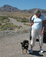
Just joined a Rockhound forum on the computer. See the links. They turned me on to a couple of websites for accessing different types of maps. Also see the links. Using one of the map-generation websites, I came up with this trip.
Day One, 4-22-2007: We hiked up a dry creek bed until we came to a valley between outcroppings. As you exit the I40 onto Mountain Springs Road it is very close to the freeway on the right. Lots of outcroppings of soft rocks, granite and such. The stream bed wildflowers still had a few blooms. It was pleasant and cool. We ate out lunch out on Lanfair on the other side of Goffs then returned on MSR again, drove by Goffs Butte, and explored a bit where Chalcedony is indicated having been found. That will be our next hike. There are several more jeep tracks to explore and photos to take.
Great website about Goffs
Saturday, April 21, 2007
Subscribe to:
Post Comments (Atom)


No comments:
Post a Comment