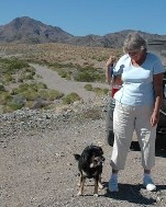
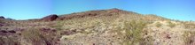
 Today Gaby and I picked up a breakfast burrito and headed toward the Park Moabi Campground exit off the I40 to check out the road to Topock Maze. Didn't take the camera this time because we got a late start and it was a little hazy.
Park Moabi Campground is a San Bernardino County Regional Park and not part of the Wildlife Refuge. But just before I40 crosses into Arizona you can just make out a little gold square of Refuge land. That is the location of the maze. Roads were washed out a bit, but it was still ok for our pickup. Made it to the maze and walked around for awhile. Will definitely go back there when the weather is cooler. The remnants of the maze is fenced with a nice sign erected at the entrance. It is much larger than I expected and very interesting. I need to find out the name of the range of mountains behind it. It is on a bluff with a great view of the Colorado River valley.
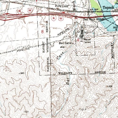
Went online to look for a topo map. Found out the mountain behind us was Whale Mountain. Found this map by linking to it from the Needles KOA Campground site. Put the link to the topo map site on the sidebar.

Did a switch to Map Detail and found what looks like an easy hike up Bat Cave Wash. Probably could park at the Maze.
Found a good site to return to and learn more about the area and the native peoples.
http://mojavedesert.net/mojave-indians/
This is a hiker's site which praises Needles Marina Campground and has a long list of places to check out.
http://www.hikercentral.com/campgrounds/102096.html


No comments:
Post a Comment